 Ulaanbaatar


Crunching Big Data to Save Lives
Politics
Ulaanbaatar /MONTSAME/ This is an open editorial by Haoliang Xu, Assistant Secretary General of the United Nations and Director of the Regional Bureau for Asia and Pacific at the United Nations Development Programme.
The Ring of Fire that encircles the Pacific Ocean is a deadly threat to countries in Asia and the Pacific region. It is notorious for seismic activity that causes earthquakes and volcanic eruptions. In 2004, the region was hit by a monster quake – its epicenter off the west coast of Sumatra.
The quake with a magnitude between 9.1-9.4 on the Richter scale, set off a series of devastating tsunamis, killing hundreds of thousands of people in countries across Asia.
The Indonesian city of Aceh was among the worst hit, more than 150,000 people lost their lives here. While Indonesia is one of the countries most prone to earthquakes, the Asia Pacific region is recognized as a zone that is prone to disasters. Since 1970, UN statistics indicate that more than two million people have been killed by natural disasters in the region, an average of 43,000 a year. But there is a way to dramatically cut down the number of people who are killed by such disasters, if we can use data to track disasters and stem risks.
Across the Asia Pacific region environmental degradation, unplanned development, and rapid urbanization are increasing the vulnerability of populations. These factors expose more people to disasters every year, causing deaths, as well as huge economic losses. Extreme weather events triggered by changing climate, hit the poorest the hardest and the worst impacts are experienced in least developed countries
If we are to save live and prevent huge damage to economies, it is critical to identify the most vulnerable populations and communities. This is where data is vital. Information about Asia Pacific’s most vulnerable populations and communities can be used to pursue so called: ‘risk-informed development.’ For instance, building infrastructure such as roads by calculating the intensity of floods. Such analysis can determine the types of materials needed to construct roads that are durable, and how high they need to be, so that they are still accessible during a flood.
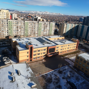
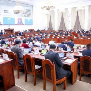
As countries of the region gather in Ulaanbaatar, Mongolia this week for the Asian Ministerial Conference on Disaster Risk Reduction to explore ways and means to prepare for and reduce the risks from disasters, a key discussion will focus on the role of technology. Specifically, how big data can save lives and protect the most vulnerable communities across the world.
Several countries in Asia and the Pacific, such as Indonesia and Sri Lanka have long been gathering data on disasters. For the last 10 years, these countries have assembled national disaster loss and damage databases that record these events. The information includes the type of disaster, areas with the highest death rates, dates and times, and narrowing down locations to districts, sub-districts and villages. This allows officials to deduce which areas are most likely to be affected and the scale of impact.
While several countries have disaster databases, none of their data had been complied to more accurately provide an analysis of regional patterns and trends. For instance, the earthquake in West Sumatra had wide-ranging impact across more than a dozen countries.
Now the UN Development Programme (UNDP), working with partners, has established National Disaster Loss and Damage databases in 16 countries. Some of these databases have more comprehensive data, which goes back decades. It can provide incisive information, on where governments need to direct public finance – planning and budgeting -- to support development priorities. It also helps identify the gaps and makes recommendations on where to allocate resources to mitigate risks from disasters.
Flood resistant roads can only be constructed if governments consider and review data about flood risks. With such information they can allocate appropriate funds for better road construction.
To further advance resilience in the region, in 2015, UNDP partnered with Tohoku University and Japanese ICT powerhouse Fujitsu, to create a Global Centre for Disaster Statistics (GCDS).
The aim is to gather and crunch ‘big data’ to meet the ambitious targets of the Sendai Framework, to reduce the risks from disasters. Fujitsu’s cloud-based ecosystem captures data from a variety of sources. This include data from both structured and non-structured sources, such as social media, high resolution satellite imagery, and drones. And it will take specialized technical institutions, like Tohoku University to crunch and analyze disaster datasets, to provide insights for policy makers about the impacts of disasters. This includes helping monitor recovery, focusing on early warning, and assessing resilience, to ensure that people are safe and secure.
Big data also provides a deeper understanding about how an economy is interconnected: how devastation of a rice crop by a disaster can trigger a chain of impact across several industries and services, such as transportation, rice-traders, packagers, supermarkets, restaurants and waiters. The biggest impact is on the livelihoods of the poor, the last and weakest link in a value-chain economy.
The global database aims to blunt such impact by providing information that will assist countries in forecasting where disasters may strike, their intensity, and the potential level of destruction. With such invaluable information governments can anticipate disasters and reduce risks through preventive measures such as early warning systems, safety drills, and building resilient infrastructure. Because the data that matters most is the number of lives saved.
The Ring of Fire that encircles the Pacific Ocean is a deadly threat to countries in Asia and the Pacific region. It is notorious for seismic activity that causes earthquakes and volcanic eruptions. In 2004, the region was hit by a monster quake – its epicenter off the west coast of Sumatra.
The quake with a magnitude between 9.1-9.4 on the Richter scale, set off a series of devastating tsunamis, killing hundreds of thousands of people in countries across Asia.
The Indonesian city of Aceh was among the worst hit, more than 150,000 people lost their lives here. While Indonesia is one of the countries most prone to earthquakes, the Asia Pacific region is recognized as a zone that is prone to disasters. Since 1970, UN statistics indicate that more than two million people have been killed by natural disasters in the region, an average of 43,000 a year. But there is a way to dramatically cut down the number of people who are killed by such disasters, if we can use data to track disasters and stem risks.
Across the Asia Pacific region environmental degradation, unplanned development, and rapid urbanization are increasing the vulnerability of populations. These factors expose more people to disasters every year, causing deaths, as well as huge economic losses. Extreme weather events triggered by changing climate, hit the poorest the hardest and the worst impacts are experienced in least developed countries
If we are to save live and prevent huge damage to economies, it is critical to identify the most vulnerable populations and communities. This is where data is vital. Information about Asia Pacific’s most vulnerable populations and communities can be used to pursue so called: ‘risk-informed development.’ For instance, building infrastructure such as roads by calculating the intensity of floods. Such analysis can determine the types of materials needed to construct roads that are durable, and how high they need to be, so that they are still accessible during a flood.
As countries of the region gather in Ulaanbaatar, Mongolia this week for the Asian Ministerial Conference on Disaster Risk Reduction to explore ways and means to prepare for and reduce the risks from disasters, a key discussion will focus on the role of technology. Specifically, how big data can save lives and protect the most vulnerable communities across the world.
Several countries in Asia and the Pacific, such as Indonesia and Sri Lanka have long been gathering data on disasters. For the last 10 years, these countries have assembled national disaster loss and damage databases that record these events. The information includes the type of disaster, areas with the highest death rates, dates and times, and narrowing down locations to districts, sub-districts and villages. This allows officials to deduce which areas are most likely to be affected and the scale of impact.
While several countries have disaster databases, none of their data had been complied to more accurately provide an analysis of regional patterns and trends. For instance, the earthquake in West Sumatra had wide-ranging impact across more than a dozen countries.
Now the UN Development Programme (UNDP), working with partners, has established National Disaster Loss and Damage databases in 16 countries. Some of these databases have more comprehensive data, which goes back decades. It can provide incisive information, on where governments need to direct public finance – planning and budgeting -- to support development priorities. It also helps identify the gaps and makes recommendations on where to allocate resources to mitigate risks from disasters.
Flood resistant roads can only be constructed if governments consider and review data about flood risks. With such information they can allocate appropriate funds for better road construction.
To further advance resilience in the region, in 2015, UNDP partnered with Tohoku University and Japanese ICT powerhouse Fujitsu, to create a Global Centre for Disaster Statistics (GCDS).
The aim is to gather and crunch ‘big data’ to meet the ambitious targets of the Sendai Framework, to reduce the risks from disasters. Fujitsu’s cloud-based ecosystem captures data from a variety of sources. This include data from both structured and non-structured sources, such as social media, high resolution satellite imagery, and drones. And it will take specialized technical institutions, like Tohoku University to crunch and analyze disaster datasets, to provide insights for policy makers about the impacts of disasters. This includes helping monitor recovery, focusing on early warning, and assessing resilience, to ensure that people are safe and secure.
Big data also provides a deeper understanding about how an economy is interconnected: how devastation of a rice crop by a disaster can trigger a chain of impact across several industries and services, such as transportation, rice-traders, packagers, supermarkets, restaurants and waiters. The biggest impact is on the livelihoods of the poor, the last and weakest link in a value-chain economy.
The global database aims to blunt such impact by providing information that will assist countries in forecasting where disasters may strike, their intensity, and the potential level of destruction. With such invaluable information governments can anticipate disasters and reduce risks through preventive measures such as early warning systems, safety drills, and building resilient infrastructure. Because the data that matters most is the number of lives saved.