The national flag
The National Flag shall be divided vertically into three equal parts colored red, blue and red. The three stripes, of identical width, shall be blue for the eternal sky in the middle, and red, the symbol of progress and prosperity, for the two stripes on either side. The Golden Soyombo shall be depicted in the centre of the red stripe nearest to the flag pole. The ratio of the width to length of the Flag shall be 1:2.
Soyombo
Since ancient times, the Soyombo ideogram has been the national emblem of freedom and independence of the Mongolians. At the top of the ideogram is a flame, which symbolizes blossoming, revival, upgrading and continuation of the family. The three prongs of the flame signify the prosperity of the people in the past, the present and the future. Below the sign of the flame there are the sun and the crescent, traditionally symbolizing the origin of the Mongolian people. The combination of the flame, the sun and the crescent expresses the wish: May the Mongolian people live and prosper. The triangles at the top and bottom of the Soyombo are a general expression of the people’s willingness to defend the freedom and independence of the country, while the rectangles are the symbols of honesty, justice and nobility. The fish, in Mongolian folklore, is a creature that never closes its eyes, i.e. remains vigilant. The two fish in the emblem symbolize the unity of the people: men and women. The cumulative meaning is: May the whole people be united, wise and vigilant. The two vertical rectangles on the sides of the emblem signify fortress walls and are a graphic representation of the ancient Mongolian saying: “Two men in friendship are stronger than walls of stone”. In the Soyombo they have the meaning: “May the whole people be unified in friendship, and then it will be stronger than the stone walls of a fortress”.
The national emblem The National emblem shall be based on the white lotus of purity. The outer frame shall be the “Tumen Nasan” of eternity in the shape of a blue sphere symbolizing the eternal sky. In the centre shall be a combination of the Golden Soyombo and the Treasured Steed, an expression of the independence, sovereignty and spirit of Mongolia. In the upper part shall be placed the Chandmani which grants wishes and symbolizes the past, present and future. In the lower part shall be a green background of mountains representing Mother Earth and the Wheel of Destiny. Mixed in with the Wheel of Destiny shall be a khadag - a scarf symbolizing welcome.
The national anthem of Mongolia
Words by Tsendiin Damdinsuren
Music by Bilegiin Damdinsuren, Luvsanjamts Murdorj
Adopted 2006 (lyrics), 1950 (music)
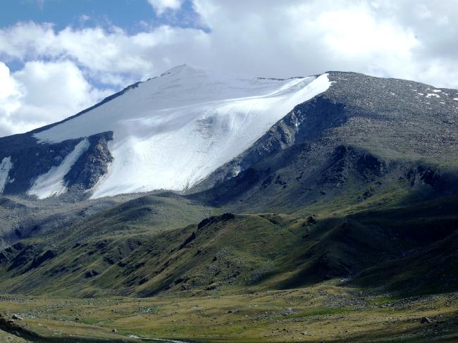
Steppe and Great Khyangan mountain eastwards. The Mongol Altai Mountains in the west run for 600-650km, with thin hills, hollows and precipitous crags of over 4,000 metres. The Khuiten peak of the Altai Tavan Bogd mountain is the highest point in the country, at 4,374 metres. There are glaciers in the heights of the Mongol Altai, and the humps and hollows of the ice-age period remain in Khuvsgul, Khangai, Khentii and the Altai mountains.
The Great Lakes Depression is in the east of the Mongol Altai and has a few hollows with big lakes. Lake Khuvsgul is like Lake Baigali, formed in cracks between mountains, running along the Khuvsgul and Darkhad Depressions. Lake Khuvsgul was formed in the Khuvsgul Depression and lake-origin steppe, and small lakes and river valleys predominate in the Darkhad Depression. The Khuvsgul mountains are in the north of the Khangai mountain range, formed by Lakes Ulaan Taiga and Khoridol Saridag, lifted 3,491 metres above sea level. A zone along the southward latitude separates the Khuvsgul Mountains. Rivers of the Tes basin and the River Delger of the Selenge basin flow from there westard and eastward. This zone was called 1905 splitting zone since a strong earthquake in 1905. A wide range of the Khangai mountains is in the centre of Mongolia. From the zone, the Bulnai, Tarvagatai and Buren mountain range continues from the Khangai range and Khangai mountain is in the splitting zone. The highest peak of the Khangai range is Otgontenger mountain, in the west of the range, at 4,021 metres, with a small glacier on top.
Topography
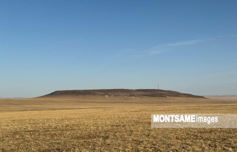
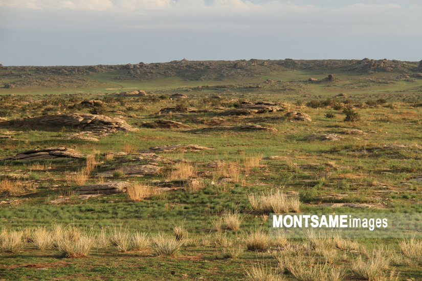
Mongolian topography consists of mountains, hummocks and high denudation plains, with three major regional stages. Erosive mountain relief and depressions of tectonic origin formed during the late Cretaceous and early Quaternary periods are numerous in the north. Erosion, tectonic depression and humps of folded mountains, lifted during the Cretaceous period’s fourth stage, occur frequently. Eighty per cent of all Mongolia is about 1,000 metres above sea level. Mongolia has most of the Mongol Altai Mountains, the Great Lakes Depression, mountains surrounding Lake Khuvsgul, the Khangai mountain range, the Orkhon-Selenge river basin, Khentii Mountain, Dornod Steppe and Great Khyangan mountain eastwards. The Mongol Altai Mountains in the west run for 600-650km, with thin hills, hollows and precipitous crags of over 4,000 metres. The Khuiten peak of the Altai Tavan Bogd mountain is the highest point in the country, at 4,374 metres. There are glaciers in the heights of the Mongol Altai, and the humps and hollows of the ice-age period remain in Khuvsgul, Khangai, Khentii and the Altai mountains.
The Great Lakes Depression is in the east of the Mongol Altai and has a few hollows with big lakes. Lake Khuvsgul is like Lake Baigali, formed in cracks between mountains, running along the Khuvsgul and Darkhad Depressions. Lake Khuvsgul was formed in the Khuvsgul Depression and lake-origin steppe, and small lakes and river valleys predominate in the Darkhad Depression. The Khuvsgul mountains are in the north of the Khangai mountain range, formed by Lakes Ulaan Taiga and Khoridol Saridag, lifted 3,491 metres above sea level. A zone along the southward latitude separates the Khuvsgul Mountains. Rivers of the Tes basin and the River Delger of the Selenge basin flow from there westard and eastward. This zone was called 1905 splitting zone since a strong earthquake in 1905. A wide range of the Khangai mountains is in the centre of Mongolia. From the zone, the Bulnai, Tarvagatai and Buren mountain range continues from the Khangai range and Khangai mountain is in the splitting zone. The highest peak of the Khangai range is Otgontenger mountain, in the west of the range, at 4,021 metres, with a small glacier on top.
Climate
There are four well-defined seasons, and on average, the sun shines for well over 200 days a year. The climate is harsh continental with low precipitation. The temperature varies greatly within the year and also diurnally. The last 60 years of meteorological observation show an annual average temperatures of 8.5C in the Gobi and -7.8C in the mountains. The extreme minimum temperature is between minus 31.1C and minus 52.9C in January. The extreme maximum temperature is between plus 28C and plus 43.1C in July. Annual precipitation is low, averaging 200-220mmm, ranging from under 50mm in the extreme south (Gobi desert) to 400mm in limited areas in the north. Most precipitation occurs in June, July and August, and the driest months are November to March. There has been more temperature increase in May and September, but little change in April. The summer temperature drop has been mainly in June and July. Temperature changes have also been spatial. Winter warming has been more pronounced in the high mountains and valleys and less in the steppe and Gobi. There is a thawing of permafrost in 63 percent of Mongolia, which some claim is due to global warming. Half of the country has an average temperature of below freezing point. The length of time of snow covering has reduced, and soil erosion has increased in recent years. The number of days with dust storms has tripled over the last 40 years.
In 1999-2002, over half of Mongolia was drought-stricken, more intense than any time in the last 60 years, coupled with dzud. These unfavorable weather factors have had an adverse effect on Mongolian social and economic development. Meteorologists stress, however, that the environmental and ecological degradation being experienced is not solely the result of weather and possible climate change, but also because of human activity. The negative effects of climate and environmental changes have influenced not only the country but also the region, as well as world countries, with the latter therefore preferring to work together. Changes in the world’s climate have been noted in north-east Asia, particularly in Mongolia. Mongolia continues to be severely affected by desertification due its geographic location, climatic conditions and its fragile ecosystem making it extremely vulnerable to desertification. In Mongolia average annual temperatures have increased by 1.56’C over the past 60 years. Droughts hit the country every 2 or 3 years, covering 25 percent of its territory and every 4 or 5 years, covering more than 50 percent of its territory. This indicates that droughts have increased by 3-4 times compared to the 1960s. Desertification is induced by several factors, including climate changes and human influences - for example, over-grazing due to over-population of livestock since the 1990s, water supply shortage, etc. Mongolia has 126.6 million hectares of pastoral land and 70 percent of this area is overgrazed. Besides this, people living in settlement areas close to dry, semi-dry and dry sub humid areas continue to consume wood plants as fossil fuels in their homes. In general, nearly 90 percent of Mongolia’s land is mildly, moderately or severely affected by desertification. Severely affected areas include the Lake Uvs depression, the Great Lakes depression, and the Dundgobi and Dornogobi aimag territories. Mildly and moderately affected areas include Mongolia’s steppe and forest-steppe zones.
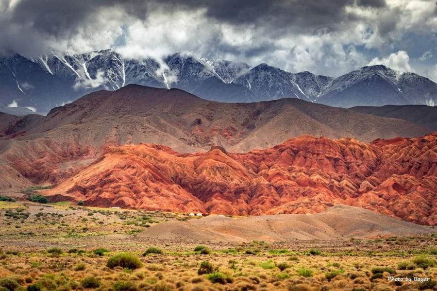
The country joined the UNCCD in 1996 and started its first program against desertification. It is now revising the ‘Strategy to Combat Desertification’ over the next 10 years as it is necessary to reconsider the program to ensure that it complies with the current and changing desertification There are more falls in river originating in the Khangai range. The valleys are rich in rapids and falls; one of the biggest falls in Mongolia is the Ulaan Tsutgalan waterfall of the Orkhon river. The Lakes Valley is in the thin depression between the mountains at the southward point of the head of the Khangai mountain range. The Gobi-Altai mountains continue 600km at the southern end of the Lakes Valley, formed by several separate mountains. The highest point of the Gobi-Altai mountains is Great Bogd mountain, at 3,957 metres. The special state-protected area of the Mongol Altai mountain includes the protected area of Khuch Serkh mountain and the natural complex of the Altai Tavan Bogd. A wide desert-like depression named Altai Uvur Gobi continues southward from the Gobi-Altai mountain and gradually changes to stony desert with dark-colored desert scraps and stone surface. The Tyan Shan, Atas Bogd and Tsagaan Bogd mountains range are at the forward end of the Altai Uvur Gobi. The central, southern and Dornod province wide steppes continue over 1,200km to the east of the head of the Khangai mountain range, Lakes Valley and Gobi-Altai mountain. This wide broad steppe falls from west to east, with a high point of 560 metres above sea level. The zenith of the Khentii mountain range is the Asralt Khairkhan mountain, 2,800 meters high, formed by basalt plateau and granite massif in the basin of River Khalkh-Gol, an east edge of Mongolia. The Khalkh-Gol river valley and its tributary rivers and steppe with fertile brown and black soil are very good for farming and an important eco-systematic reserve, keeping nature in its relatively original condition.
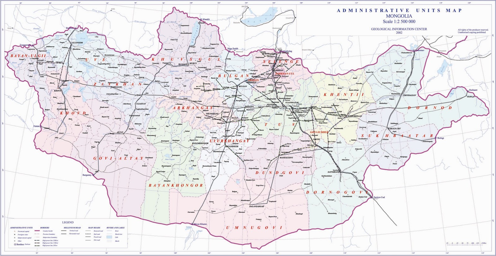
Aimags of MongoliaArkhangaiTo top
Center: Tsetserleg. located 291 miles (468 km) from Ulaanbaatar.
Established: 1931 year
Area: 55'313.82 km2
Ethnic group: Uuld and Khalkh
Arkhangai aimag is situated in the central part of the Khangai mountain range and its territory comprises mountains, steppe and plains. Over 70 percent of the territory of the aimag is pasture land, almost 2 percent with hay fields, about 1 percent with sown area, and 15 percent of the territory is covered with deciduous and coniferous forest.
Bayan UlgiiTo top
Center: Ulgii. located 1055 miles (1,698 km) from Ulaanbaatar.
Established: 1940 year
Area: 45'704.89 km2
Ethnic group: 93% - Kazakh, 7% - Durvud, Uriankhai, Tuva, Khalkh
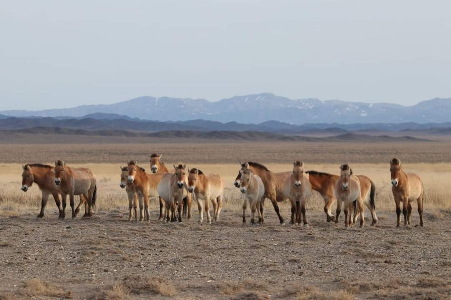
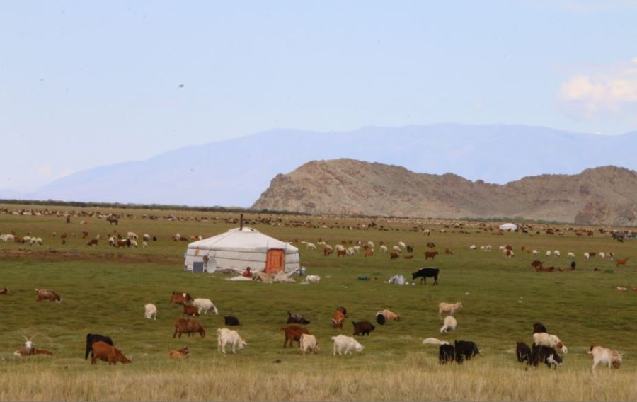
Bayan-Ulgii is a far-off land of high mountains (the Mongol Altai - Tavan Bogd mountains with 4,373 m peak) torrents and glaciers, inhabited by Kazakh, a minority who has a different culture from the Mongols, herding yaks and goats and hunting with trained eagles.
Bayan-Ulgii aimag is situated in the extreme West of Mongolia, on the West and North it borders with the Russian Federation and on the South-West with the People's Republic of China.
The ethnic groups who call Bayan-Olgii home are comprised of the Kazakh, Khalkh. Durvud, Uriankhai and Tuva. Unlike the rest of Mongolia, which is dominated by the Khalkh Mongols. About 90% of Bayan-Ulgii's population are Kazakh, almost all of them Muslim. The remaining 10% are mostly obscure minority groups.
Many people in the aimag speak Kazakh, so if you have spent time perfecting some conversational Mongolian, you may be devastated because many Kazakhs won't be able to understand you. There is bound to be someone nearby, however, who speaks Mongolian and, possibly Russian, but certainly nothing else.
BayankhongorTo top
Center: Bayankhongor , located 385 miles (630 km) from Ulaanbaatar.
Established: 1941 year
Area: 115'977.8 km2
Ethnic group: Khalkh, Torguud and Kharchin
The aimag is located in the western central region of Mongolia, 630km away from the capital. Travel distance is comparable with going to Umnugobi which is a popular tourist destination. Bayankhongor is located close to Ulaanbaatar than many other aimags such as Khuvsgul, Dornod, Zavkhan, Uvs and Khovd.
International tourists come to Arkhangai and Khuvsgul aimags to explore Mongolia's forests and mountains and travel to Umnugobi aimag for the famous Gobi sceneries. Bayankhongor contains fascinating nature out of all three regions: forested mountain ranges, steppes and Gobi Desert.
Getting around the town is pretty easy. You can walk from one side to the other in less than 30 minutes. Even the airport is within easy walking distance if you don't have too much luggage. Taxis in Bayankhongor work like they do elsewhere in Mongolia, wave down a random car or go to the market to hire one. Taxis to the villages (or soums) surrounding Bayankhogor gather at the market. Most drivers live in the villages and drive into Bayanhongor in the morning, leaving in the afternoon.
BulganTo top
Center: Bulgan , located 205 miles (330 km) from Ulaanbaatar.
Established: 1938 year
Area: 48'733 km2
Ethnic group: Khalkh, Buryat, Bayad, Khoton and Sartuul
Bulgan is located in the northern region - Orkhon and Selenge river basins bordering to Selenge, Tuv, Uvurkahngai, Arkhangai and Khuvsgul provinces respectively and to the Russia for 160km border line. It is overall a mountainous area. The province is rich in resource of anthracite and other constructive materials and there was an earthquake in Mogod Sum forming many land splits that show the surface of the area has not been completely formed yet.
Bulgan is abundant of different species of fauna and flora. Also home to many protected wildlife species, such as a moose, elk, bear, roe deer, wild boar, musk deer, lynx, fox, wolf, marmot and birds such as barrede owl, eagle, partridge, grouse, vulture, goose, stork and duck and fish such as taimen, perch, luce, ruff and red eyed fish.
Gobi-AltaiTo top
Center: Altai , located 624 miles (1,005 km) from Ulaanbaatar.
Established: 1940 year
Area: 141'447.67 km2
Ethnic group: Khalkh, Kharchin and Torguud.
Gobi-Altai aimag (Gobi-Altai in mongolian) is situated in the western part of Mongolia. On the South-West it borders with the People's Republic of China. The Sutai, Azh Bogd, Tayan, Edren, Burkhan buudai majestic peaks of the Mongol Altai mountains stretch from North to South through the territory of the aimag.
Mongolia's second-largest aimag is named after the Gobi Desert and the Mongol Altai Nuruu range, which virtually bisects the aimag to create a stark, rocky landscape.
Most of the population live in the north-east corner, where melting snow from the Khangai Nuur feeds small rivers, creating vital water supplies.
GobisumberTo top
Center: Choir city, located 137 miles (220 km) from Ulaanbaatar.
Established: 1994 year
Area: 5'541.8 km2
Ethnic group: Khalkh, Durvud, Bayad, and Kharchin
Gobisumber aimag is situated in the South-East part of the central regions of Mongolia. About 80 percent of aimag's land is suitable for extensive animal husbandry. The aimag is located in the steppe zone . It's climate is extreme continental.
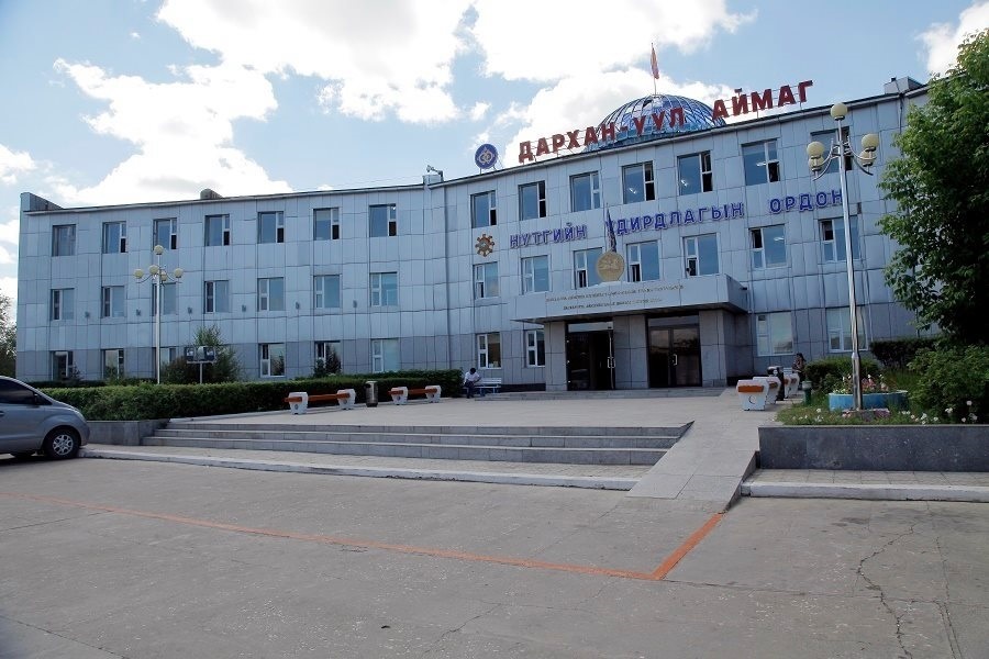
Darkhan-UulTo top
Center: City of Darkhan, located 143 miles (230km) from Ulaanbaatar.
Established: 1994 year
Area: 3'275 km2
Ethnic group: Khalkh, Durvud, Bayad, Torguud and Tuva
On 17 October, 1961, the foundation of Darkhan city was laid in the economically favorable land of Darkhan somon, in Selenge aimag.
The somon was abolished and the settlement came under the new Darkhan Administration, in 1963. Joint-ventures with the assistance of former socialist countries were set up in Darkhan in 1970 - 1990, that have significantly contributed to the city's development and today it is a highly industrialized region of Mongolia. As Darkhan aimag used to be a part of Selenge aimag, biodiversity and climate are quite similar to those in Selenge. 76 percent of the population of Darkhan - Uul aimag live in Darkhan, of which 86 percent lives in residential apartments.
Darkhan-Uul province lies between the Khangai and Khentii mountain ranges in the Orkhon and Selenge’s vast river valleys. In the 32,750 square kilometers of this province there are many places of great natural beauty.
By the end of the year 2004, the province population was 90,400 with people originating from every corner of Mongolia. Like the Mongolian population as a whole, most of the residents of Darkhan are young people.
Darkhan-Uul Aimag’s infrastructure includes paved roads, an international railway, modern telecommunication systems and reliable energy sources. It is well connected by the main railway system to Russia and China with a north-south railroad through Ulaanbaatar and Darkhan City.
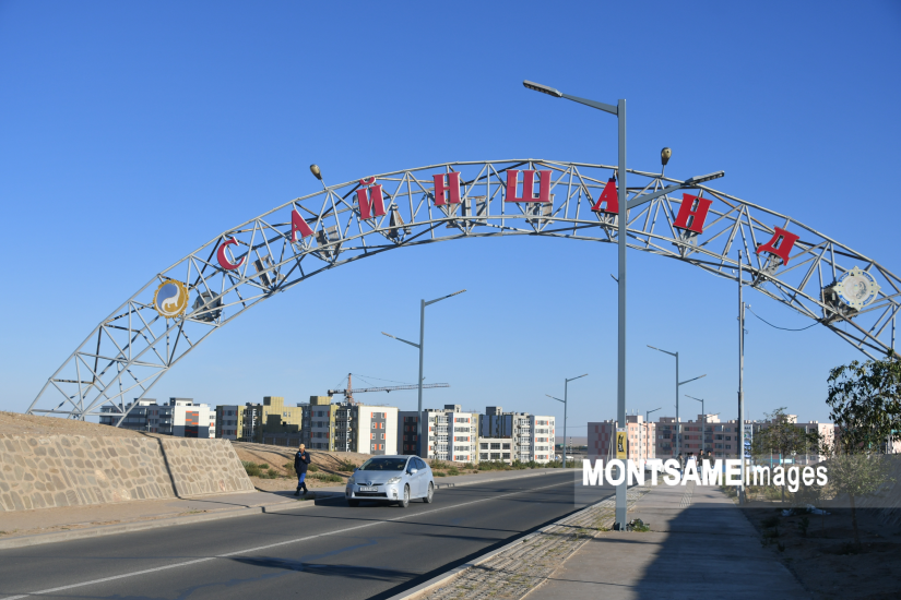
DornogobiTo top
Center: Sainshand , located 283 miles (456 km) from Ulaanbaatar.
Established: 1931 year
Area: 109'472 km2
Ethnic group: Khalkh, Buryat and Dariganga
Dornogobi aimag is situated in the South-East of the country and borders on the South with the People's Republic of China. This wide area is a semi-desert zone, with a hard and sandy soil.
Territory is famous for medical herbs such as liquorice, cuscuta australis, and annual, perennial species, including wild leek, saksaul, elm, allium mongolicum and saltwort. Of wild animals there are wild horse, wild sheep, ibex, black tailed antelope, white antelope and lynx. Birds include condor and eagle. These species can be found on the hills of Otsol, Sansara, Ikhe and Baga Dulaan, Argalant, Khorgo, Budryn Uul, in the steppe of the Tuulait and Tariachfh, in the hollows of Gurban Bayan, Unegt, Tughum, and on the wide semi-desert of Bulan saaral, Gurvan Khashaat, Khonich, Burdene Uul, Dalai Bumbat. Railway over 311 miles (500 km) long crosses 6 somons. Infrastructure consists of railway, telecommunications and roads.
The territory of the Dornogobi aimag Is dotted with rocks that appeared during various ages is Mongolia's Gobi Desert region. Under pristine conditions and with its wealth of stone tools, petroglyphs, bronze and iron tools, tombs, ruins of cities and towns, and other valuable historical and cultural monuments the Gobi Desert attests to being the birthplace of mankind, as does its significant paleontological discoveries, such as the petrified fossils of dinosaurs that existed over 80 million years ago, sea creatures and plants, petrified wood, footprints of marsh heron, zebu, and ostriches inhabiting the area 30 million years ago.
The region has been explored over a lengthy period by the Italian trader Marco Polo, the Russian geographer N. M. Prjevalsky, the Russian scientist and geographer V. I. Obruchev, Russian tourist P. M. Kozlov, and other scientists and researchers, all of whom havedevoted a sizeable number of their research works to the flora and fauna and geographical landscape of the aimag, and to the traditions and lifestyles of its human inhabitants.
Dornogobi aimag is located in the desert steppe zone of southeastern Mongolia. It is one of the hottest and most windswept areas of the country.
The flora and fauna typical of desert steppe zones is widespread throughout Dornogobi.
Whilst there are no large rivers in the territory of the aimag, it does have sizeable resources of subterranean water and many small lakes, rivers and springs.
Dornogobi numbers over 1 million head of livestock, mostly sheep and goats.
Founded in 1931, the Province borders on the Sukhbaatar aimag to the east, on the Khentii and Gobisumber aimags to the north and borders China to the south. Covering an area of 115 thousand sq. km, Dornogobi has a population of 50 thousand, 70 percent of which live in towns and settlement areas.
The center of the aimag, Sainshand, is 463 km from Ulaanbaatar City and is a main international railway hub.
Dornogobi has a railway station linking Moscow-Ulaanbaatar-Beijing, a medical museum, the music and drama theater named after Noble Saint Danzanravjaa, an ethnographic museum, an electrical power plant, food mills, and trade and cultural centers.
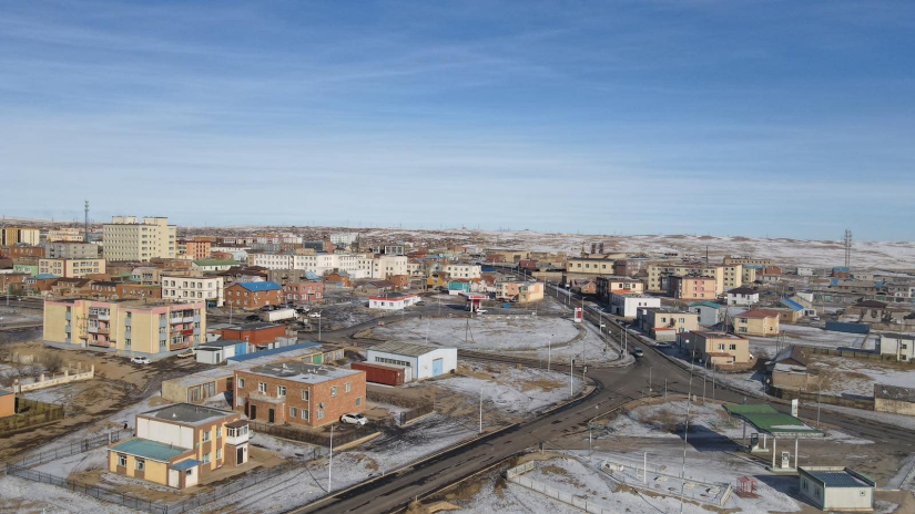
Sainshand. Population 20,000. Elevation 938m. One of Mongolia's most dusty and dry aimag capitals, Sainshand (Good Pond) is important primarily because of it's location. The city was founded in 1931 and was called Tushet Khan aimag during Manchu rule. It is on the main rail line to China, and not far from the Chinese border.
DornodTo top
Center: Choibalsan town, located 408 miles (656 km)from Ulaanbaatar.
Established: 1931 year
Area: 123'597.43 km2
Ethnic group: Barga, Uzemchin, Khalkh and Buryat
Dornod aimag borders on the North with the Russian Federation and on the East and South-East with the People's Republic of China.
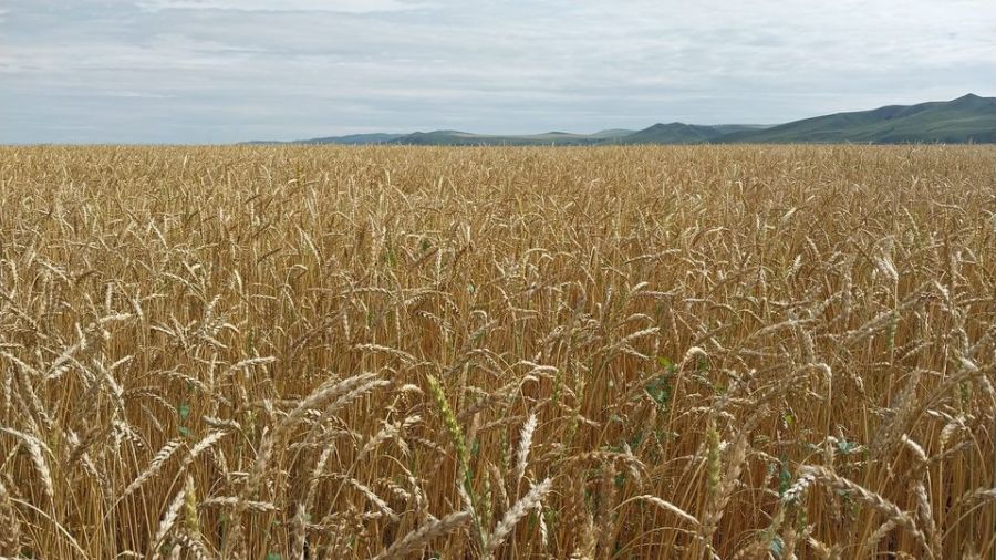
The population is predominantly Khalkha, but Buryat and Barga nationalities live in Ereentsav of Bayan-Uul, Bayandun, Dashbalbar, and Tsagaan-Ovoo somons. Gurvan-zagal, and Khuluunbuir somons are populated by the Uzemchin. 4/5 of the territory is hilly. The vast steppes of Menen, Matad, and Tamsag cover the territory of 186 miles (300 km) in the East with some parts reaching 93 miles (150 km.) in width. 93-124 miles (150-200 km) along both sides of the Kherulen river lie steppes. Also there are high mountains along the sides of the Uuiz river, and low hills along the sides of the Onon river. The annual precipitation is 10-12 inches (250-300 mm). Onon, Kherulen, Khaikh, Uuiz are the biggest rivers. Numerous lakes could be found in Dornod, such as Khukh, Galuut, Bayan, Bulan and Buir. The Buir lake is the biggest, fresh water lake, others are salt lakes. In the territory of the aimag, there are many springs, the most famous ones being Tsagaan Khundii, Utaat Minjuur, Ereen, Tsagaan chuluut. Deer, elks, raccoon, boars, otter and white antelope's habitat is in the basins of the Onon and Ulz rivers, and Khyangan mountain range. Marmots prefer the steppe. Bears, boars, and muskrats habitat is the basin of the Onon river. Wolf and fox can be seen everywhere, and squirrel and lynx in some places. Soil is black and brown and rich in pasture grass. Basins of the rivers are quite fertile. Dornod aimag has a relatively well developed infrastructure. 81.3 percent of the total arable land, or around 10.0 million hectares are either cultivated or used as pasture. 118 square miles are under cultivation for wheat growing and around 1.5 square miles for growing vegetables.
DundgobiTo top
Center: Mandalgobi town, located 165 miles (265 km) from Ulaanbaatar
Established: 1942 year
Area: 74'690.32 km2
Ethnic group: Khalkh
Dundgobi Aimag is the middle segment of the Gobi-desert. Dundgobi Aimag has an area of 74,700 square kilometers and population of 51.300 inhabitants. The administrative center is the town of Mandalgobi at an altitude of 1,393 meters sea level in the vast open steppe, 260 kilometers from Ulaanbaatar. The territory of the aimag is the central part of the Middle Khalhasain Plain. Total local livestock herd is 1.5 million heads.
ZavkhanTo top
Main town: Uliastai
Territory: 82500 км²
Distance: 1023km from UB
Geography & Climate
Established in 1923 and located western side of Khangai Mountain Ranges. The territory divides into multi geological zones;
forest, forest-steppe, steppe, semi desert-steppe, gobi desert regions. Only province with the territory includes many geological regions in Mongolia. It means many lakes and rivers, hot spas, sand dunes, wild animals you can see in Zavkhan.
Highest point is Otgontenger mountain (4021m) just 80 kilometres to west from Uliastai city, which is main city of Zavkhan province. One of the coldest place in winter time (reached to -53°C). Borders with Uvs, Arkhangai, Gobi-Altai, Khuvsgul provinces Republic of Tuva, Russian Federation by north.
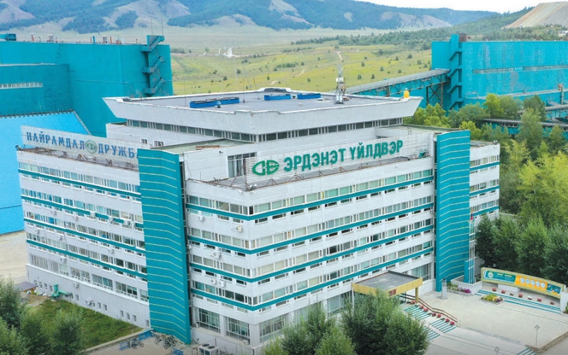
OrkhonTo top
Center: Erdenet, located 371 km from Ulaanbaatar.
Established: 1994 year
Area: 844 km2
Ethnic group: Khalkh, Durvud, Buryat, Bayad, Uriankhai and Khoton
Erdenet city, one of the greatest constructions of the 20th century, was initially established as Erdenet khoroo (administrative unit )of Bulgan province, on January 1st of 1976 later it was extended to Erdenet city, and is currently the third largest city of Mongolia. In 1994, according to the territorial-administrative reforms, it was re structured as Orkhon province with two sums, Bayan-Undur and Jargalant.
UvurkhangaiTo top
Main town: Arvaikheer
Territory: 63500 км²
Distance: 431 km from UB
Geography & Climate
Uvurhangai province located in central Mongolia and has various topography such as branches of Khangai and Gobi-Altai Mountains, forest, steppe, and Gobi Desert so that the climate is capricious. Going down from north to south region, It becomes warm as the rainfall decreases. The average annual rainfall is 306.1mm-117.2mm.
Year around temperature reaches up to 35°C and lowest temperature dropes down to 35.8°C below zero. The territory accommodates many beautiful landscapes, historical sites, ancient city ruins, biggest waterfall, high mountain lakes, dead volcano, so on. All those places are pinned in Mongolian tourist map nicely. Get it and find them.
UmnigobiTo top
Main town: Dalanzadgad
Territory: 165500 км²
Distance: 575 km from UB
Geography & Climate
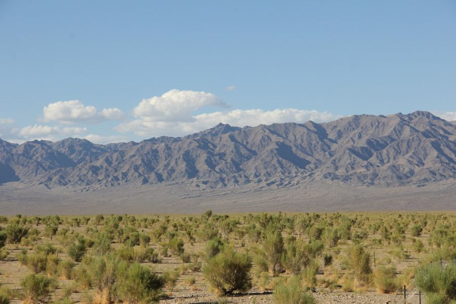
Biggest province in Mongolia, Umnugobi means “South Gobi”, whole territory of the province locates in southern Mongolian gobi desert regions. Unlike the Sahara, there are few sand dunes in the Gobi, rather you'll find large barren expenses of gravel plains and rocky outcrops. Experts considered that Mongolian gobi was a bottom of sea in ancient time. The climate here is extreme. Temperatures reach up to +40°C summer, -30°C in winter. Precipitation averages less than 100mm per year, while some areas only get rain once every two or three years. Strong winds up to 140 km/h make travel dangerous in spring and fall.
SukhbaatarTo top
Main town: Baruun Urt
Territory: 82900 км²
Distance: 565km from UB
Geography & Climate
Sukhbaatar province founded 1943. It’s territory lies on the Mongolian Great Eastern plains. You can find it south east corner of Mongolian map. Borders with Inner Mongolia, Republic of China by south, west to north Dornogobi, Khentii, Dornod provinces.
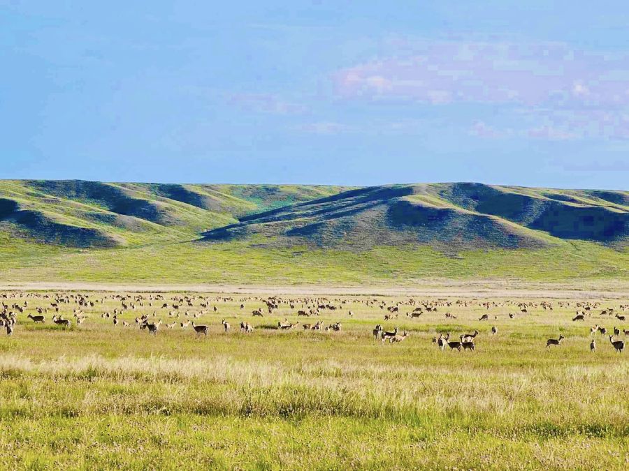
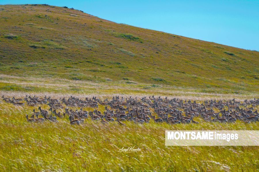
Home of 200 dead volcanos, hundreds of thousands of gazelles and other wild animals. Climate is dry and shows huge daily temperature range.
Most of the territory has problem with lack of water source, that brings difficulties to human settlements and infrastructure developments of province.
SelengeTo top
Main town: Sukhbaatar
Territory: 43000 км²
Distance: 321 km from UB
Geography & Climate
An Agriculture and farm based Selenge province is located at the beautiful forest-steppe region and Selenge, Orkhon, Kharaa and Eroo river basins of Northern Mongolia. It borders Russia in the north; Bulgan in the west, Tuv in the south, and Khentii in the east. It embeds Darhan-Uul province at the center. There is a significant daily temperature difference. The ground is frozen and there is a heavy snow during the winter. Average temperate is between 25°C ~ -35°C. Rainfall is mainly distributed between summer and autumn. Annual rainfall is 300 ~ 400mm. Roads, railways widely developed and used for domestic and international transport.
TuvTo top
Main town: Zuun mod
Territory: 74800 км²
Distance: 45 km from UB
Geography & Climate
Geologically north to south, Khentii mountain ranges ends in middle of the territory of Tuv province and Dornod Mongolian Great Steppe region starts here. Tuv province means “Central“ because of its location. It includes the western part of the Khentii Mountains, the mountains around the capital, as well as rolling steppe in the south and west. The capital city Ulaanbaatar locates in the deep in territory of Tuv province.
The province is well-known of its springs and spa resorts as well as Janchivlan, Buuruljuut, Khundgan, Yestii, Suuj. These spa resorts are full every season because these exceptional springs are confirmed to treat the human health.
Except Tuul River which is crosses the Ulaanbaatar; one of the beautiful and hidden lakes in this province is Khagiin Khar. It is in the middle of forest, which is unreachable by vehicle. The place is abundant with fishes/ lenok, taiman/, birds and wild life /wolf, bear, elk, deer, fox/. It is worth seeing and fishing lake for tourists.
UvsTo top
Main town: Ulaangom
Territory: 69585 км²
Distance: 1417km from UB
Geography & Climate
Uvs province located in western part of Mongolia, a place called as a Ikh Nuuruudiin Xotgor, means "Great Lakes Depression" of Altai Mountains. It has a capricious climate. The air pressure is up to 1054hPa, and the temperature is down to -50°C(highest) in January. It is the coldest place in Mongolia. Average rainfall is 100mm to 300mm annually. Multi ethnic Uvs province named as a name of Uvs lake - biggest lake of Mongolia. Also Uvs lake is protected and listed as a “ Uvsunur Hollow” in “World Heritage Site” UNESCO, UN in 2003. To the north, it borders with Russia; to the East, Zavkhan; to the south, Khovd; and to the west, Bayan Ulgii provinces.
KhovdTo top
Main town: Khovd
Territory: 76000 км²
Distance: 1487km from UB
Khovd province is home to diverse ethnic groups; Khalkh majority and the Khoton, Kazakh, Uriankhai, Zakhchin, Myangad, Oold and Torguud peoples.
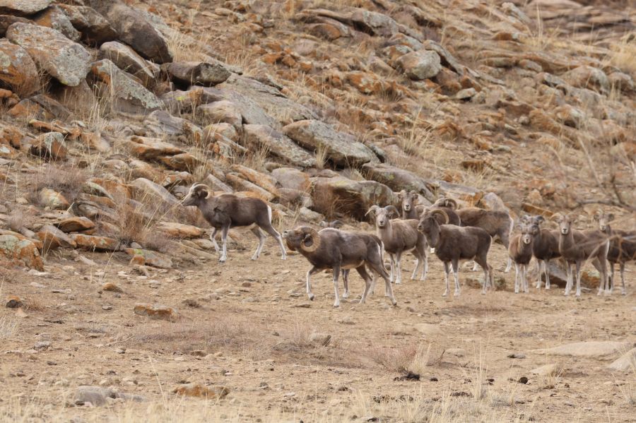
Khovd is an important habitat for ibex and argali sheep. It's home to Mönkh Khairkhan Uul (4362m, Tavan Khumit), the second highest mountain in Mongolia. You can walk up the peak if you approach from the northern side. There is plenty of snow and ice on top, so you’ll need crampons, an ice axe and rope, but the climb is not technically difficult. A 4WD trail runs to the base from Mankhan sum (district).
Territory of Khovd province situated approximately 2200 metres above the sea level in High Altai Mountain range. Famious for snow topped high mountains. The average winter temperature is -17°C ~ -25.5°C, and 15°C ~ 25°C summer time.
KhuvsgulTo top
Main town: Murun
Territory: 109600 км²
Distance: 779 km from UB
Geography & Climate
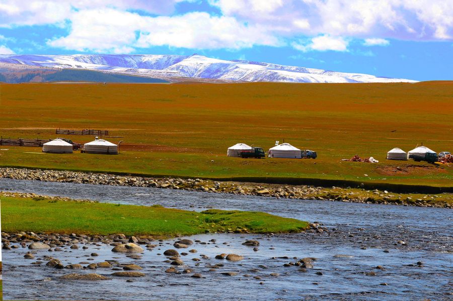
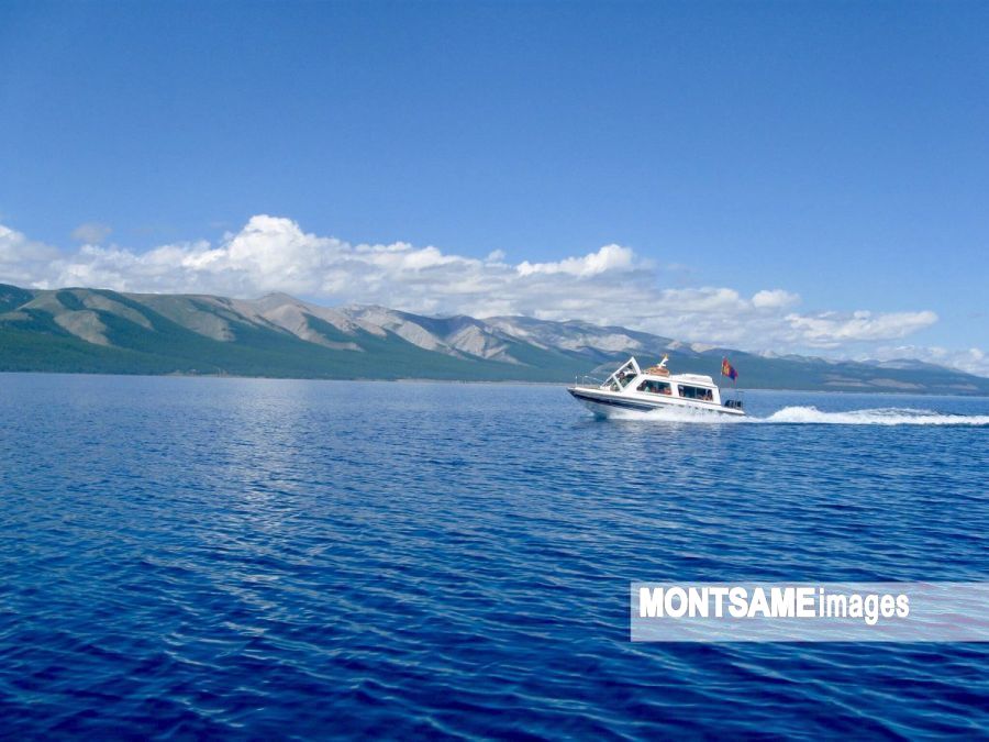
Khuvsgul province is located in largely mountainous area in the northernmost Mongolia. The nature beauty is one of the well known destinations for tourists. There are fresh water lake Khuvsgul, Reindeer people, full fished Tsagaan lake, Salmon and huge taimen can also be found in the lake, Darkhad Depression(Valley) is one of Mongolia's strongest centre of shamanism.
Lake Khuvsgul 1% of world freshwater resources alone and Khuvsgul province described as a “Mongolian Switzerland” by travelers from all over the world. The largest forest areas of Mongolia are located around and to the north of the lake, extending the southern Siberian Taiga region.
KhentiiTo top
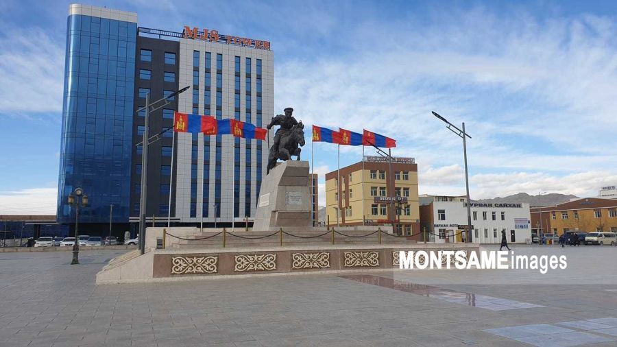
Main town: Chinggis (Undurkhaan)
Territory: 83000км²
Distance: 338 km from UB
Geography & Climate
The Birthplace of Chinggis khaan - Man of Second Millenium. He was born and raised to the world from the territory of Khentii province.
Geological location of Khentii is the the basin of Kherlen, Onon, and Ulz rivers. It contains almost all of the Khentii Mountain area and divided into three regions with different soil and ecosystems due to its geographical features and climate: Taiga region of Khentii Mountain, Mongol Daguur - the forest-steppe region, steppe region of Eastern Mongolian Vast Grassland. Average temperature during summer at 15°C~35°C, winter -18°C~-37°C. Annual precipitation in Khentii Region 320mm - 200mm in steppe region. One of Mongolian ethnic Buryad people lives north of Khentii province.


 The National Flag shall be divided vertically into three equal parts colored red, blue and red. The three stripes, of identical width, shall be blue for the eternal sky in the middle, and red, the symbol of progress and prosperity, for the two stripes on either side. The Golden Soyombo shall be depicted in the centre of the red stripe nearest to the flag pole. The ratio of the width to length of the Flag shall be 1:2.
 Since ancient times, the Soyombo ideogram has been the national emblem of freedom and independence of the Mongolians. At the top of the ideogram is a flame, which symbolizes blossoming, revival, upgrading and continuation of the family. The three prongs of the flame signify the prosperity of the people in the past, the present and the future. Below the sign of the flame there are the sun and the crescent, traditionally symbolizing the origin of the Mongolian people. The combination of the flame, the sun and the crescent expresses the wish: May the Mongolian people live and prosper. The triangles at the top and bottom of the Soyombo are a general expression of the people’s willingness to defend the freedom and independence of the country, while the rectangles are the symbols of honesty, justice and nobility. The fish, in Mongolian folklore, is a creature that never closes its eyes, i.e. remains vigilant. The two fish in the emblem symbolize the unity of the people: men and women. The cumulative meaning is: May the whole people be united, wise and vigilant. The two vertical rectangles on the sides of the emblem signify fortress walls and are a graphic representation of the ancient Mongolian saying: “Two men in friendship are stronger than walls of stone”. In the Soyombo they have the meaning: “May the whole people be unified in friendship, and then it will be stronger than the stone walls of a fortress”.
 The National emblem shall be based on the white lotus of purity. The outer frame shall be the “Tumen Nasan” of eternity in the shape of a blue sphere symbolizing the eternal sky. In the centre shall be a combination of the Golden Soyombo and the Treasured Steed, an expression of the independence, sovereignty and spirit of Mongolia. In the upper part shall be placed the Chandmani which grants wishes and symbolizes the past, present and future. In the lower part shall be a green background of mountains representing Mother Earth and the Wheel of Destiny. Mixed in with the Wheel of Destiny shall be a khadag - a scarf symbolizing welcome.