Ulaanbaatar
Climate Change and Human Activity Accelerate Decline of Mukhart River
Environment
Ulaanbaatar, September 9, 2025 /MONTSAME/. A clear indicator of the accelerating decline in river water levels, driven by global warming, climate change, and desertification, can be observed in the Mukhart River, located in Erdenekhairkhan soum of Zavkhan aimag, the western part of Mongolia.
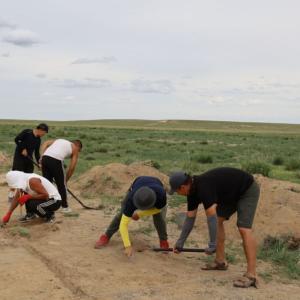
Tourist activity at the Mukhart River, particularly sliding down through dunes, has led to the accumulation of sand over the river’s headwaters, causing a gradual decline in water flow and levels.
In response, the Minister of Environment and Climate Change of Mongolia, Batbaatar Bat, has directed the Water Department under the Government of Mongolia to implement protective measures, enhance the river’s flow, clarify its hydrological sources, and initiate policy-level actions to preserve the river’s original landscape and ecosystem.
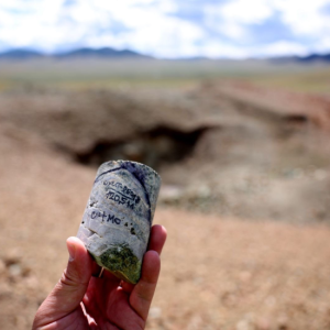
Located in the Altan Bag area of Erdenkhairkhan soum, Zavkhan aimag, 30 kilometers northeast of the soum center and 110 kilometers from the aimag center, the Mukhart River originates from a 450-meter-high dune on the southern side of Bor Khyar Sand dunes. The river flows for 8.2 kilometers before disappearing beneath the sand. The area is renowned for its striking natural formations, dense willow thickets, fennel, gentian, native fruits of red currant, and sweet briar.
Between 2021 and 2024, the Khyargas Nuur-Zavkhan River Basin Administration conducted research on the Mukhartyn River to assess its resource potential. The study revealed a 5 cm decline in water level in the river’s middle section, a reduction in flow velocity by 0.2-0.4 meters per second, an average change of 3.5 meters in the height of dunes near the source, and a 5.2-meter advance in dune movement over the period.